Environmental data / Project notes
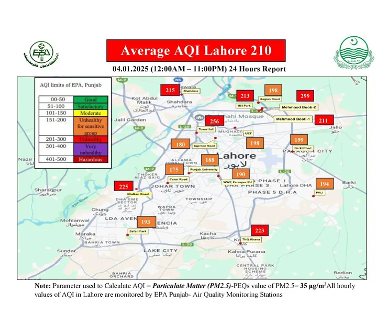
Lahore AQI Mapping
Making local data legible.
01 / The context
Start with the problem. Find the useful solution.
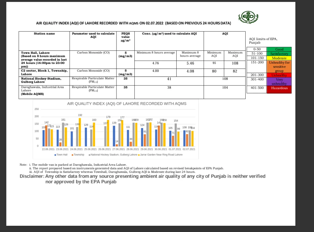
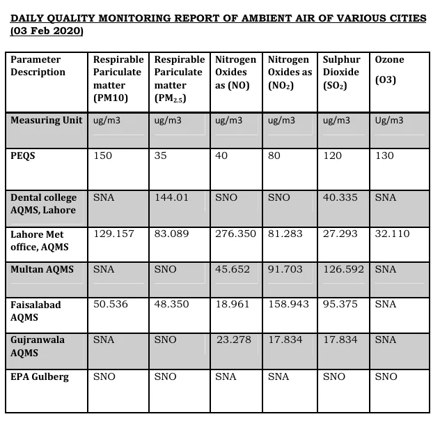
Public air-quality reporting was difficult to interpret at a local, decision-ready level.
Built a compact geospatial data workflow that gathers official readings and presents localized AQI conditions clearly.
02 / The work
Thoughtful on the surface.
Considered underneath.
A practical interface for understanding city-level air-quality conditions.
- Data collection
- Geospatial mapping
- AQI reporting
- Automation
TypeScriptNode.jsPostGISLeaflet
Have something in mind?